Showing 89 items matching department of conservation
-
 Kiewa Valley Historical Society
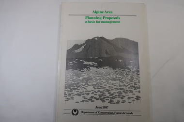
Book - Book - Alpine Area - Department of Conservation, Forests & Lands, Alpine Area / Planning Proposals / a basis for management. 1987
... Book - Alpine Area - Department of Conservation, Forests...Victorian Department of Conservation Forests & Lands... - Alpine Area - Department of Conservation, Forests & Lands Book ...It is the policy of the Government that most of the State's alpine area will be proclaimed as an Alpine National Park, which would complement the Kosciusko National Park in N.S.W.. This is yet to be achieved (1987), however there is a need for sound, efficient and coordinated management based on the area's natural features, values and uses. Planning is proceeding on this basis.Victoria's alpine area is one of the State's most outstanding and spectacular natural areas. It is noted for its diverse plant and animal life, scenery, recreation opportunities and as a water catchment. This country is at the upper end of the Kiewa Valley and the planning for it is of interest to the Kiewa Valley inhabitants.White bound book with green print for title at the top, black & white picture and black print at the bottom for the name of the government authority publishing the book.143 pages with fold out map after page 7. The map is coloured green to indicate the planning area.alpine area, bogong national park, victorian department of conservation forests & lands -
 Wodonga & District Historical Society Inc
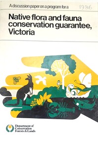
Book - Discussion Paper on Native flora and fauna conservation guarantee, Victoria, Department of Conservation, Forests and Lands, Victoria, 1986
... On bottom of front - Logo Department of Conservation...Department of Conservation, Forests and Lands, Victoria ... Department of Conservation, Forests and Lands An A4 size document ...This publication was produce as a discussion paper to inform decisions related to changes in land management and conservation regulations and policy in 1986An A4 size document outlining findings into an investigation into the state of flora and fauna in Victoria.This publication was produce as a discussion paper to inform decisions related to changes in land management and conservation regulations and policy in 1986land management, conservation victoria, water conservation -
 Orbost & District Historical Society
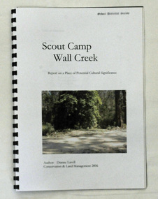
book, Scout Camp Wall Creek, 2006
... for the Department of Conservation and Land Management in Orbost. She...Department of Conservation and Land Management... was written by Dianne Lavell for the Department of Conservation ...This report was written by Dianne Lavell for the Department of Conservation and Land Management. Dianne Lavell worked for the Department of Conservation and Land Management in Orbost. She was a long time resident of Orbost. A spiral bound, plastic covered book titled Scout Camp Wall Creek. It is a report on Scout Camp at Wall Creek in Orbost. It contains description and history of the site deemed to be a place of potential cultural significance. on the front cover is a coloured photo of the site.scout-camp-wall-creek -
 Orbost & District Historical Society
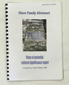
book, Close Family Allotment, 2006
... for the Department of Conservation and Land Management, Victoria. Martin...Department of Conservation and Land Management... for the Department of Conservation and Land Management, Victoria. Martin ...This report was compiled by Martin Healey for the Department of Conservation and Land Management, Victoria. Martin Healey, a long time Orbost resident, worked for the Department of Conservation and Land Management in Orbost.This is a useful research tool.A small spiral bound book of 30 pp with a plastic cover. It is a report written by Martin Healey and details the close Family allotments at Murrangower, east of Orbost. -
 Orbost & District Historical Society
map/brochure, Discovering Marlo & The Snowy River Estuary, December 1988
... In 1983 the Department of Conservation, Forests and Lands...Department of Conservation, Forests and Lands... of Conservation, Forests and Lands replaced the Department of Crown Lands ...In 1983 the Department of Conservation, Forests and Lands replaced the Department of Crown Lands and Survey, the Department of State Forests and the Ministry for Conservation. This brochure/map was used as tourist information in Orbost.This item is a useful research tool.A folded map/brochure titled "DISCOVERING MARLO & THE SNOWY RIVER ESTUARY". On the front is a photograph of Marlo and the title in yellow print. There is a locality map for access to Corringle beach and the brochure Includes a key to fishing sites and various tourist locations. On the back of the brochure are notes on fishing, wildlife and a boating guide, map brochure snowy-river marlo -
 Orbost & District Historical Society
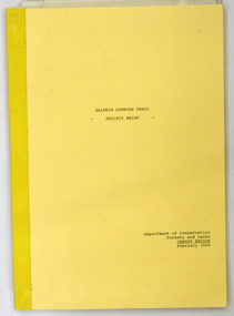
document, BALDWIN SPENCER TRAIL Project Brief 1988, February 1988
... This document was produced by the Department...Department of Conservation, Forests and Lands... was produced by the Department of Conservation, Forests & Land ...This document was produced by the Department of Conservation, Forests & Land Management, Orbost, to commemorate the visit by Baldwin-Spencer in 1989 as part of the Bicentennial Walking Tracks Project. The Baldwin Spencer Trail closely follows the route of scientist and explorer William Baldwin Spencer. Sir Walter Baldwin Spencer KCMG (23 June 1860 – 14 July 1929) was an English-Australian biologist and anthropologist. this booklet is a useful reference tool.A document of 10 pp with a cream cover, titled, Baldwin Spencer Trail Project Brief Feb 1988. It contains mapsbaldwin-spencer -
 Whitehorse Historical Society Inc.
Article, VicRoads angers Greens, 1994
... Victoria. Department of Conservation and Natural Resources... without a valid permit from the Department of Conservation... the Department of Conservation and Natural Resources. Koonung Mullum... the Department of Conservation and Natural Resources. Koonung Mullum ...The Opposition and Koonung Mullum Forestway Association have claimed VicRoads has started removing protected vegetation.The Opposition and Koonung Mullum Forestway Association have claimed VicRoads has started removing protected vegetation along the Koonung Valley without a valid permit from the Department of Conservation and Natural Resources. Koonung Mullum Forestway Association are holding a protest rally.The Opposition and Koonung Mullum Forestway Association have claimed VicRoads has started removing protected vegetation. clubs and associations, koonung mullum forestway association, victoria. department of conservation and natural resources, pullen, barry, vicroads, eastern freeway -
 Orbost & District Historical Society
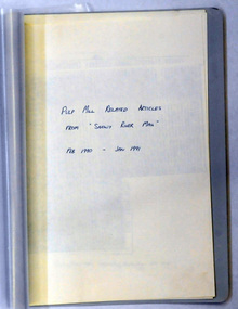
document, PULP MILL RELATED ARTICLES from "Snowy River Mail" Feb 1990 -Jan 1991, 1990 / 1991
... This folder of articles was compiled by the Department...Department of Conservation and Land Management... by the Department of Land & Water Conservation / Forestry. This item ...This folder of articles was compiled by the Department of Land & Water Conservation / Forestry.This item is a useful reference tool on the pulp /paper mill proposed for East Gippsland.A small 8 pp folder of photocopied articles from the Snowy River Mail. They relate to the pulp/paper mill proposal in East Gippsland. pulp-mill-orbost -
 Wheen Bee Foundation
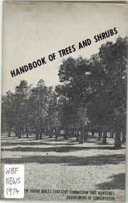
Publication, New South Wales Forestry Commission Tree Nurseries, Handbook of Trees and Shrubs (New South Wales Forestry Commission Tree Nurseries), Sydney, 1974
... Sydney, Department of Conservation ... -
 Whitehorse Historical Society Inc.
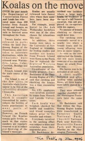
Article, Koalas on the move, 14/01/1986 12:00:00 AM
... victoria. department of conservation forests and lands... of koalas by the Department of Conservation, Forests and Lands.... by the Department of Conservation, Forests and Lands. wildlife koalas ...Article from 'The Post' 14 January 1986 about relocation of koalas by the Department of Conservation, Forests and Lands.Article from 'The Post' 14 January 1986 about relocation of koalas by the Department of Conservation, Forests and Lands.Article from 'The Post' 14 January 1986 about relocation of koalas by the Department of Conservation, Forests and Lands.wildlife, koalas, victoria. department of conservation forests and lands -
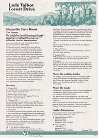 Marysville & District Historical Society
Flyer (item) - Information Flyer, Department of Conservation, Forests & Lands, Lady Talbot Forest Drive, February 1988
... Department of Conservation, Forests & Lands... sugarloaf logging victoria walking tracks Department of Conservation ...A flyer with information on Lady Talbot Forest Drive and the attractions in the area surrounding it.A flyer with information on Lady Talbot Forest Drive and the attractions in the area surrounding it. Lady Talbot Drive a 24 kilometer scenic rainforest car journey which passes a number of walks and waterfalls in the Yarra Ranges National Park. Lady Talbot Drive is named after Lady Sarah Elizabeth, the wife of Sir Reginald Talbot, who was the Governor of Victoria from 25th April, 1904 to 6th July 1908.7761(F1)lady talbot drive, lady talbot forest drive, marysville state forest, sir reginald talbot, lady sarah elizabeth talbot, wishing well, taggerty river, phantom falls, keppel falls, beeches walking track, marysville, mount sugarloaf, logging, victoria, walking tracks -
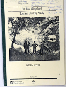 Orbost & District Historical Society
book / document, Far East Gippsland Tourism Strategy Oct 1987, October 1987
... Department of Conservation, Forests and Lands.... tourism-east-gippsland Department of Conservation, Forests ...The project team for this document comprised E. Beacham, T. Claridge, B. Ebbs, C. Wilso. and J. Cristofaro.This booklet is a useful refernce tool.A document of 86 pp, titled Far East Gippsland Tourism Strategy Study Interim Report October 1987. it has a cream cover and black binding with a b/w photograph of four people in a bushland setting. It contains fold-out maps.tourism-east-gippsland -
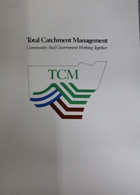 Wodonga & District Historical Society Inc
Booklet - Total Catchment Management: Community and Government Working Together, Department of Conservation and Land Management, C. 1993
... Department of Conservation and Land Management..., Department of Conservation and Land Management ...Information sheets outlining the need for Total Catchment Management and what this approach means for management into the future,non-fictionInformation sheets outlining the need for Total Catchment Management and what this approach means for management into the future,catchment management, water resources australia -
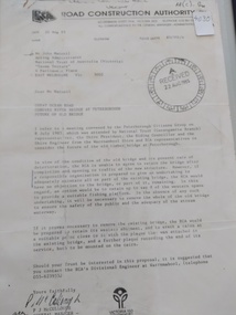 Peterborough History Group
Document - Three letters pertaining to the retention of the Old Bridge
... department of conservation forest & lands... the Department of Conservation Forests & Lands to Mr John Irvine... the Department of Conservation Forests & Lands to Mr John Irvine. And one ...Upon confirmation that a new bridge was to be built, there was some discussion about the possibility of retaining the old bridge for pedestrian purposes, or part of the old bridge as a fishing platform. These letters are part of the correspondence re an organisation taking responsibility for the ongoing maintenance so the old bridge could be retained.The old bridge was constructed of locally sourced timber and was such an important structure to the town when built. Its sentimental value saw locals attempt (although unsuccessfully) to retain the old bridge.Two A4 Typewritten letters, one from the Road Construction Authority to the National Trust Australia, the other from the Department of Conservation Forests & Lands to Mr John Irvine. And one hand written letter.RCA letter is stamped "Received 22 Aug 1985", Dept of Conservation Forests & Lands has a pencilled phone no inscribed.peterborough, curdies river bridge, old peterborough bridge, department of conservation forest & lands, road construction authority -
Whitehorse Historical Society Inc.
Article, Apex needs new blood, 1991
... victoria. department of conservation and lands.... They have just won a grant from the Department of Conservation... a grant from the Department of Conservation and Lands to construct ...Nunawading Apex club urgently wanting new members.Nunawading Apex club urgently wanting new members. They have just won a grant from the Department of Conservation and Lands to construct an observation tower at the rear of the waste transfer station on Burwood Highway, but they need more members to carry the project through, says Geoff Secker,. membership chairman.Nunawading Apex club urgently wanting new members. service clubs, secker, geoff, victoria. department of conservation and lands, nunawading apex club, waste transfer station, vermont south -
 Marysville & District Historical Society
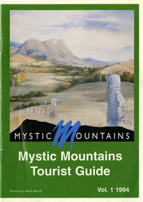
Ephemera (Item) - Tourist Guide, Michael Nash et al, Mystic Mountains Tourist Guide Vol. 1 1994, 1994
... department of conservation & natural resources... and Progress Association, Marysville/ Office of the Department... of the Department of Conservation & Natural Resources, Shire/ of Alexandra ...A tourist guide outlining services, accommodation, activities and places of interest to visit in and around Marysville and the local district.A tourist guide outlining services, accommodation, activities and places of interest to visit in and around Marysville and the local district.ACKNOWLEDGEMENTS:/ Marysville and District Tourist and Progress Association, Marysville/ Office of the Department of Conservation & Natural Resources, Shire/ of Alexandra Visitors Guide and all our advertisers whom without/ their support this publication would not have been possible.marysville, victoria, australia, tourist guide, mystic mountains, michael nash, dudley jones, marysville and district tourist and progress association, department of conservation & natural resources, shire of alexandra, paperwork professionals, pp art services, harrier printing, darrowby deer farm, heidi boesch, hidden talent craft gallery, olde yarra track shoppe, lady talbot forest drive, mathilde's of marysville country guest house, wishing well, taggerty river picnic area, taggery river, phantom falls, keppel falls, the beeches walking track, mount sugarloaf, beauty spot walk, tree fern gully walk, michaeldene track, keppel track, woods lookout track, marysville caravan park, baree mud brick cottages, cumberland scenic reserve, nanda binya lodge, cambarville, the big tree, barton's lookout, cumberland falls, our lady of the snows catholic church, anglican church christ, marysville christian fellowship, sovereign view, the big culvert, st fillan, steavenson's restaurant, the birches resort, cathedral range state park, tower motel, marysville post shop, lake mountain, wirreanda festival, cross country ski hire, marysville hotel motel, kerami house, marysville holiday cottages, missing links miniature golf, top shop pancake parlour, marylands guest house, dalrymples guest cottages, crossways country inn, esa camping & conference centre, scenic motel, the cumberland, maryton park holiday cottages, lomatia lodge holiday house, willowbank gallery and art centre, igloo roadhouse, a model tours, geoffrey pope & associates -
Federation University Historical Collection
Booklet, Little Desert National Park and Wail State Forest Proposed Management Plan, 1991, 11/1991
... Department of conservation and environment... management plan horsham Department of conservation and environment ...Grey soft covered report of 80 pages. Includes a pull out map.little desert national park, wait state forest, management plan, horsham, department of conservation and environment, rod gowans, don spence, wimmera river, threatened plants, fauna, flora, birds, mammals, wergaia, scarred trees, mounds, pest plants, pest animals, tourism and recreation, timber, grazing, conservation -
Federation University Historical Collection
Book, Alex Sideratos et al, Anderson's Mill Smeaton - Main Report. Student Project, 1992
... department of conservation and natural resources... management issues conclusion the courier ballarat department ...Anderson's Mill Smeaton - Main Report. Student Project.White bound book of 80 pages and includes five appendices.anderson's mill, smeaton, alex sideratos, ozlem soyogul, michael pearlman, jane lennon, chris smith, simon nelly, barry golding, russel dawe, margaret giles, ross squires, executive summary, introduction, methodology, swot analysis, site analysis, concept/product analysis, summary of market research, other development options to consider, community involvement, preferred option & cost analysis, marketing recommendations, management issues, conclusion, the courier ballarat, department of conservation and natural resources, creswick business promotions committee, creswick, daylesford, kingston, allendale, flour mill, anderson brothers, convent gallery daylesford, mill restaurant malmsbury, oat mill -
 Whitehorse Historical Society Inc.
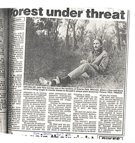
Article, Forest under threat, 13/09/1986 12:00:00 AM
... victoria. department of conservation forests and lands... victoria. department of conservation forests and lands ...An article in the Nunawading Gazette, naturalist John Reid has asked Council to commission a survey of flora and fauna of Antonio Park, Mitcham before this significant bushland remnant is impossible to save.native plants, antonio park, mitcham, reid, john, robinson, randall, victoria. department of conservation forests and lands -
 Whitehorse Historical Society Inc.
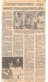
Article, Conservationists to urge weed management plan, 5/04/1989 12:00:00 AM
... victoria. department of conservation.... environment weeds victoria. department of conservation forests ...Article from Nunawading Gazette dated 5 April 1989 about a weed management plan in the City of Nunawading.environment, weeds, victoria. department of conservation, forests and lands., native plants, edwards, margaret, meagher, dorothy, witherspoon, cameron, david -
 Marysville & District Historical Society
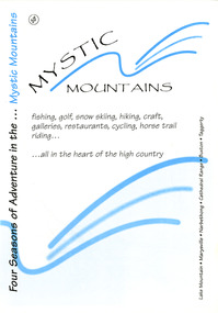
Ephemera (Item) - Visitor information pack, Four Seasons of Adventure in the Mystic Mountains, Unknown
... department of conservation & environment victoria... sugarloaf department of conservation & environment victoria ...A visitor information pack on Marysville and the surrounding district.A visitor information pack on Marysville and the surrounding district.marysville, victoria, australia, visitor information pack, lake mountain, narbethong, cathedral range, buxton, taggerty, mystic mountains, beauty spot walk, tree fern gully walk, michaeldene track, keppel track, woods lookout track, lady talbot forest drive, wishing well, taggerty river picnic area, taggerty river, phantom falls, keppel falls, the beeches walking track, mount sugarloaf, department of conservation & environment victoria -
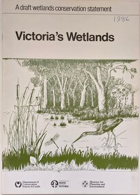 Wodonga & District Historical Society Inc
Book - Victoria's Wetlands, Dept. of Conservation, Forests & Lands, 1986
... On foot of cover: Department of Conservation, Forests... of Conservation, Forests & Lands, Department of Water Resources, Victoria ...This publication was the result of an inquiry into the state of wetland environments in Victoria. It produced a draft strategy for conservation of threatened areas in the future.An 22 page book containing maps and illustrationsThis publication was the result of an inquiry into the state of wetland environments in Victoria. It produced a draft strategy for conservation of threatened areas in the future.wetland protection, wetlands victoria, water conservation -
 The Beechworth Burke Museum
Photograph, c1930
... Department of Land & Water Conservation... by Austral Archaeology, which was done when the Department of Land... the Department of Land & Water Conservation was doing work to improve ...Taken on 25 October 1930, various houses with the Hume Dam under construction are depicted in the background. The construction of the Hume Dam took place from 1919 to 1936. At the time of construction, it was the second largest dam in the world. It was also one of the earliest civil projects developed after the Federation. Some of the Dam workers consisted of World War I veterans. Dam workers often settled their families in Mitta Junction Village and Wodonga. Archaeological surveys were completed by Austral Archaeology, which was done when the Department of Land & Water Conservation was doing work to improve Hume Dam. The archaeological report that came out of the survey recommended three sites of interest where archaeological excavation should be done: Camp Ganger’s Quarters, Stableman’s Quarters, and the Industrial Dump. The excavation uncovered artefacts. Mitta Mitta: Mitta Mitta is situated between Mount Welcome and Mount Misery. It is named after the river that explorers Hume and Hovell discovered in 1824. The town would eventually become a huge gold mining town. Mitta Mitta is called Midamodunga by the local Indigenous peoples Wodonga: Wodonga is situated on the Murray River and is part of North East Victoria. Hume and Hovell: Hamilton Hume (1979-1873) and William Hilton Hovell (1786-1875). W. H. Hovell was born in Norfolk England and Hume was born in Parramatta, New South Wales Hovell and Hume undertook an exploration journey in 1824 and thought they discovered a river, which turned out to be the Murray River. They returned home in 1825, but returned to the area in 1826 and discovered coal in the area. This photo is historically significant as it shows the Hume Dam under construction in 1930. The Dam was named after Hamilton Hume, who is an important historical figure for this area as he helped discover the area where resources were found.Sepia rectangular photograph printed unmountedReverse: 84-19-5 / 1997.3185/ Values & spillway. / When completed the wall / will be as high as the / scaffolding. [featuring trademark: kodak print]construction, houses, veterans, mitta junction village, hume dam, world war i, federation, wodonga, archaeological survey, excavation, austral archaeology, department of land & water conservation, camp ganger's quarter's, stableman's quarters, industrial dump, artefacts, mitta mitta, mount welcome, mount misery, murray river, hamilton hume, william hilton hovell, hume and hovell expedition -
 The Beechworth Burke Museum
Photograph, c1930
... Department of Land & Water Conservation... by Austral Archaeology, which was done when the Department of Land... the Department of Land & Water Conservation was doing work to improve ...Taken on 25 October 1930, various houses with the Hume Dam under construction are depicted in the background. The construction of the Hume Dam took place from 1919 to 1936. At the time of construction, it was the second largest dam in the world. It was also one of the earliest civil projects developed after the Federation. Some of the Dam workers consisted of World War I veterans. Dam workers often settled their families in Mitta Junction Village and Wodonga. Archaeological surveys were completed by Austral Archaeology, which was done when the Department of Land & Water Conservation was doing work to improve Hume Dam. The archaeological report that came out of the survey recommended three sites of interest where archaeological excavation should be done: Camp Ganger’s Quarters, Stableman’s Quarters, and the Industrial Dump. The excavation uncovered artefacts. Mitta Mitta: Mitta Mitta is situated between Mount Welcome and Mount Misery. It is named after the river that explorers Hume and Hovell discovered in 1824. The town would eventually become a huge gold mining town. Mitta Mitta is called Midamodunga by the local Indigenous peoples Wodonga: Wodonga is situated on the Murray River and is part of North East Victoria. Hume and Hovell: Hamilton Hume (1979-1873) and William Hilton Hovell (1786-1875). W. H. Hovell was born in Norfolk England and Hume was born in Parramatta, New South Wales Hovell and Hume undertook an exploration journey in 1824 and thought they discovered a river, which turned out to be the Murray River. They returned home in 1825, but returned to the area in 1826 and discovered coal in the area.This photo is historically significant as it shows the Hume Dam under construction in 1930. The Dam was named after Hamilton Hume, who is an important historical figure for this area as he helped discover the area where resources were found.Sepia rectangular photograph printed unmountedReverse: 84-19-2/ 1997.3188/ These are the four / release valves they are / not always open (illegible) this / when closed the water flows / over the spillway. [featuring trademark: kodak print] photograph number: 354construction, houses, veterans, mitta junction village, hume dam, world war i, federation, wodonga, archaeological survey, excavation, austral archaeology, department of land & water conservation, camp ganger's quarter's, stableman's quarters, industrial dump, artefacts, mitta mitta, mount welcome, mount misery, murray river, hamilton hume, william hilton hovell, hume and hovell expedition -
 The Beechworth Burke Museum
Photograph, 25 October 1930
... Department of Land & Water Conservation... by Austral Archaeology, which was done when the Department of Land... by Austral Archaeology, which was done when the Department of Land ...Taken on 25 October 1930, various houses with the Hume Dam under construction are depicted in the background. The construction of the Hume Dam took place from 1919 to 1936. At the time of construction, it was the second largest dam in the world. It was also one of the earliest civil projects developed after the Federation. Some of the Dam workers consisted of World War I veterans. Dam workers often settled their families in Mitta Junction Village and Wodonga. Archaeological surveys were completed by Austral Archaeology, which was done when the Department of Land & Water Conservation was doing work to improve Hume Dam. The archaeological report that came out of the survey recommended three sites of interest where archaeological excavation should be done: Camp Ganger’s Quarters, Stableman’s Quarters, and the Industrial Dump. The excavation uncovered artefacts. Mitta Mitta: Mitta Mitta is situated between Mount Welcome and Mount Misery. It is named after the river that explorers Hume and Hovell discovered in 1824. The town would eventually become a huge gold mining town. Mitta Mitta is called Midamodunga by the local Indigenous peoples Wodonga: Wodonga is situated on the Murray River and is part of North East Victoria. Hume and Hovell: Hamilton Hume (1979-1873) and William Hilton Hovell (1786-1875). W. H. Hovell was born in Norfolk England and Hume was born in Parramatta, New South Wales Hovell and Hume undertook an exploration journey in 1824 and thought they discovered a river, which turned out to be the Murray River. They returned home in 1825, but returned to the area in 1826 and discovered coal in the area.This photo is historically significant as it shows the Hume Dam under construction in 1930. The Dam was named after Hamilton Hume, who is an important historical figure for this area as he helped discover the area where resources were found.Sepia rectangular photograph printed unmountedReverse: 84-19-6/ 1997.3187/ The spillway [featuring trademark: kodak print] construction, houses, veterans, mitta junction village, hume dam, world war i, federation, wodonga, archaeological survey, excavation, austral archaeology, department of land & water conservation, camp ganger's quarter's, stableman's quarters, industrial dump, artefacts, mitta mitta, mount welcome, mount misery, murray river, hamilton hume, william hilton hovell, hume and hovell expedition -
 The Beechworth Burke Museum
Photograph, 25 October 1930
... Department of Land & Water Conservation... by Austral Archaeology, which was done when the Department of Land... was done when the Department of Land & Water Conservation was doing ...Taken on 25 October 1930, various houses with the Hume Dam under construction are depicted in the background. The construction of the Hume Dam took place from 1919 to 1936. At the time of construction, it was the second largest dam in the world. It was also one of the earliest civil projects developed after the Federation. Some of the Dam workers consisted of World War I veterans. Dam workers often settled their families in Mitta Junction Village and Wodonga. Archaeological surveys were completed by Austral Archaeology, which was done when the Department of Land & Water Conservation was doing work to improve Hume Dam. The archaeological report that came out of the survey recommended three sites of interest where archaeological excavation should be done: Camp Ganger’s Quarters, Stableman’s Quarters, and the Industrial Dump. The excavation uncovered artefacts. Mitta Mitta: Mitta Mitta is situated between Mount Welcome and Mount Misery. It is named after the river that explorers Hume and Hovell discovered in 1824. The town would eventually become a huge gold mining town. Mitta Mitta is called Midamodunga by the local Indigenous peoples Wodonga: Wodonga is situated on the Murray River and is part of North East Victoria. Hume and Hovell: Hamilton Hume (1979-1873) and William Hilton Hovell (1786-1875). W. H. Hovell was born in Norfolk England and Hume was born in Parramatta, New South Wales Hovell and Hume undertook an exploration journey in 1824 and thought they discovered a river, which turned out to be the Murray River. They returned home in 1825, but returned to the area in 1826 and discovered coal in the area.This photo is historically significant as it shows the Hume Dam under construction in 1930. The Dam was named after Hamilton Hume, who is an important historical figure for this area as he helped discover the area where resources were found.Black and white rectangular photograph printer unmountedReverse: 84-20-1/ 1997.3147construction, houses, veterans, mitta junction village, hume dam, world war i, federation, wodonga, archaeological survey, excavation, austral archaeology, department of land & water conservation, camp ganger's quarter's, stableman's quarters, industrial dump, artefacts, mitta mitta, mount welcome, mount misery, murray river, hamilton hume, william hilton hovell, hume and hovell expedition -
 The Beechworth Burke Museum
Photograph, 25 October 1930
... Department of Land & Water Conservation... by Austral Archaeology, which was done when the Department of Land... was done when the Department of Land & Water Conservation was doing ...Taken on 25 October 1930, various houses with the Hume Dam under construction are depicted in the background. The construction of the Hume Dam took place from 1919 to 1936. At the time of construction, it was the second largest dam in the world. It was also one of the earliest civil projects developed after the Federation. Some of the Dam workers consisted of World War I veterans. Dam workers often settled their families in Mitta Junction Village and Wodonga. Archaeological surveys were completed by Austral Archaeology, which was done when the Department of Land & Water Conservation was doing work to improve Hume Dam. The archaeological report that came out of the survey recommended three sites of interest where archaeological excavation should be done: Camp Ganger’s Quarters, Stableman’s Quarters, and the Industrial Dump. The excavation uncovered artefacts. Mitta Mitta: Mitta Mitta is situated between Mount Welcome and Mount Misery. It is named after the river that explorers Hume and Hovell discovered in 1824. The town would eventually become a huge gold mining town. Mitta Mitta is called Midamodunga by the local Indigenous peoples Wodonga: Wodonga is situated on the Murray River and is part of North East Victoria. Hume and Hovell: Hamilton Hume (1979-1873) and William Hilton Hovell (1786-1875). W. H. Hovell was born in Norfolk England and Hume was born in Parramatta, New South Wales Hovell and Hume undertook an exploration journey in 1824 and thought they discovered a river, which turned out to be the Murray River. They returned home in 1825, but returned to the area in 1826 and discovered coal in the area. This photo is historically significant as it shows the Hume Dam under construction in 1930. The Dam was named after Hamilton Hume, who is an important historical figure for this area as he helped discover the area where resources were found. Black and white rectangular photograph printer unmountedReverse: 1997.3145/ 84-20-2construction, houses, veterans, mitta junction village, hume dam, world war i, federation, wodonga, archaeological survey, excavation, austral archaeology, department of land & water conservation, camp ganger's quarter's, stableman's quarters, industrial dump, artefacts, mitta mitta, mount welcome, mount misery, murray river, hamilton hume, william hilton hovell, hume and hovell expedition -
University of Melbourne, Burnley Campus Archives
Plan, Alton-Hascombe Feature Survey, c. 1990
... 1 tracing paper and 2 paper copies, plan by Department... tracing paper and 2 paper copies, plan by Department ...1 tracing paper and 2 paper copies, plan by Department of Conservation, Forests and Lands. Division of Survey and Mapping. Scale 1:1000. Plan of property includes buildings, gardens and paddocks. 1 copy has significant buildings coloured.alton-hascombe, survey -
Federation University Historical Collection
Report, Read Sturgess and Associates Consulting Economists et al, The Economic Significance of Grampians National Park, 1994 (and other reports), 1990-4
... of Grampians National Park for the Department of Conservation... of Grampians National Park for the Department of Conservation ....1) Grampians Surround Strategy, 1990 .2) Tourism and the Grampians Region: A Background Paper, 1990 .3) Grampians Surround Strategy and Discussion Paper, 1991 .4) The Economic Significance of Grampians National Park for the Department of Conservation and Natural Resources, 1994Notes in pencil by Mary Hollick, lecturer in Tourism at the University of Ballarat.victorian tourisim industry, tourism, halls gap, grampians, grampians national park, recreation, water production, bee keeping, arapiles, dunkeld, balmoral, pomonal, wartook, population, agriculture, water supplies, minerals, hamilton, ararat, stawell, horsham, wimmera, koorie heritage, aboriginal heritage, koorie art sites, brambuk, waterways, wannon river, wimmera river, mount william creek, rocklands reservoir, lake lonsdale, lake fyans, lake toolando, cherrypool, mirranatwa, zumstein -
Stawell Historical Society Inc
Book - Report, Grampians National Park Draft Management Plan, 1985
... . A Division of the department of Conservation, Forest and Lands... to National Park Service, Victoria. A Division of the department ...For Public comment to National Park Service, Victoria. A Division of the department of Conservation, Forest and LandsSoft Cover with B/W Photo of aerial view of ranges of Grampians. Black taped Spine binding.$5 Barry Clugston